By: Manuel Baumann – Skyquest
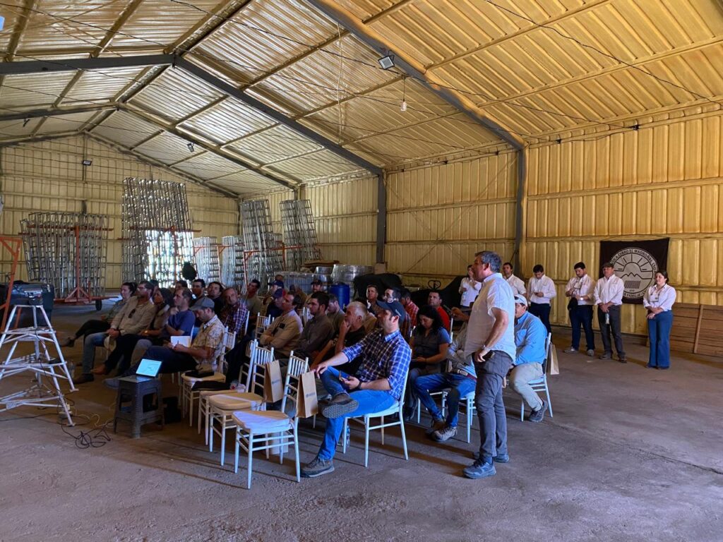
Recently, the use of drones has become widespread in all types of activities, not just recreational ones. Their constant technological development has allowed them to incorporate technologies that facilitate their operation, while their price is increasingly more affordable.
As a concept, drones (or RPAs – Remotely Piloted Aircraft or UAV – Unmanned Aerial Vehicles) are aerial vehicles that can be operated remotely and whose flight can be fully or partially automated. In this way, they can perform complex, repetitive or dangerous activities, without affecting the safety of equipment, people or the environment.
Agriculture has always been based on the observation of certain phenomena, which allow us to determine their behavior and uniformity. Therefore, the more we can observe them, the better we understand their processes and influence their growth.
Today, drone observation is an alternative method that is positioned between manual observation (on foot) and satellite images.
Each method has its advantages and disadvantages.
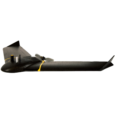
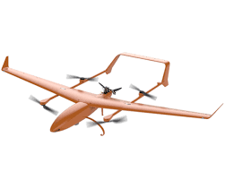

Drones are also divided into multirotor and fixed-wing drones. The latter are better at covering large areas, while the former are better for static work or applications. Recently, hybrid drones called VTOL have been developed, which combine the vertical takeoff and landing of the former with the coverage of the latter.
In agriculture, drones have multiple uses, including image/video capture, aerial photogrammetry and obtaining images for precision agriculture, among others.

Photography and video: Of course, the most widespread use of drones is to obtain photographs or videos of a field, with the aim of carrying out marketing actions. However, a little-explored use (because it is more difficult to obtain and interpret) is the capture of images that allow us to identify agricultural management problems (multispectral maps). With the right images, it is easy to see damage from root compaction, irrigation problems, poor handling of machinery and equipment, plant counting, observing damage from floods and storms, among others.

Aerophotogrammetry: In simple terms, it is the capture of images, which allows for large-scale topography to be carried out in a very short time (compared to traditional methods). It is one of the most complex techniques, as it requires topographic support on the ground, very complex digital post-processing, as well as digital cartography. However, when well executed, it is a technique that can generate results that are of much higher quality than the traditional process, in a fraction of the time that would be required to do it manually.

This technique not only allows us to obtain very precise plans of the fields, but also to generate digital models of the terrain, which in turn allow us to take all the measurements we want, without having to go back to the field.
All of this at a centimetric level of precision. We can measure lengths, widths, surfaces and volumes of anything that is within the generated model, thereby saving not only time, but also the cost of re-hiring specialists each time it is necessary. Thus, not only is the cost of the initial survey justified, but great savings are obtained in the short, medium and long term.
This type of work allows planning of medians, divisions, irrigation and much more.
Consecutive surveys over time allow us to make accurate comparisons and evaluate the progress of the field's condition, with objective data.
Precision Agriculture: In this regard, it is worth differentiating at least two segments: mapping and agricultural applications.

- Mapping: Drones are capable of carrying different types of cameras, which will obtain different information, depending on what we seek to understand:
- RGB Cameras: They are cameras that capture colour images (like those on your cell phone), but specially adapted for use in drones. Apart from the first two uses described above (photography and aerial photogrammetry), they are essential for obtaining an orthophoto of the location.
Through complex processes, an Orthophoto is generated, which is a very detailed visual map of the sector. This gives us an aerial view that helps explain many of the phenomena being analysed.- Multispectral Cameras: They are sensors specially designed to obtain information on biomass. They are capable of differentiating what happens at the level of the epidermis (and therefore, with the photosynthetic process, chlorophyll concentrations, etc.), from what happens in the mesophyll (a consequence of nutrition), as well as analyzing leaf density, among other phenomena.
A good multispectral camera will have at least 4 independent sensors, which will measure visible and non-visible light bandwidths, from whose information vegetative indices are then extracted, such as the widely used NDVI (incorrectly called “vigor index”), but also many more.
Since the information obtained is precise (resolutions of a few centimetres can be obtained) and repeatable (since the flight can be automated), it is advisable to carry out the flights at the different phenological stages of the crop, since only in this way will it be possible to obtain effective measurements of the improvements in yield and reduction of achievable costs. Carrying out monitoring over several seasons will allow us to generate measurable and substantial increases in production and efficiency improvements.
These “vigor maps” can be transformed into zoning (simplifications of the information obtained), and combined with agronomic recipes, which allow agronomic application equipment, such as tractors with GPS and sprayers with automatic dispensers, to drastically increase their efficiency, applying only where it is really necessary.
- Multispectral Cameras: They are sensors specially designed to obtain information on biomass. They are capable of differentiating what happens at the level of the epidermis (and therefore, with the photosynthetic process, chlorophyll concentrations, etc.), from what happens in the mesophyll (a consequence of nutrition), as well as analyzing leaf density, among other phenomena.
- Thermal Imaging Cameras: These cameras measure infrared radiation and thus allow us to obtain the temperature of objects. Their use in the field allows us to obtain a clear impression of the level of water stress in plants, but also of irrigation problems, the appearance of groundwater on the surface, night images and much more.
- Others: There are many other types of cameras that drones can carry, such as hyperspectral cameras, LIDAR, and more. This article is not intended to be an exhaustive analysis of all technologies, but rather of the most accessible and widely used methods in agriculture.

The correct interpretation of these images and indices will depend on the knowledge of the field, its cultivation, processes and history, as well as the specialized agronomic advisor who will correlate the data obtained with the reality in the field and will be able to help achieve significant improvements in production and a reduction in operating costs.
In expert hands, they allow us to collect complex information efficiently, which, combined with expert advice, allows us to increase production and reduce costs, thus significantly improving profitability.